|
Links:
Home
About Us
Advancement
Alumni
Archive
Forms
Greenbar
Leaders
Links
Mothers Auxiliary
Order
of the Arrow
Parents' Resources
Scoutcraft
Troop Portal
|
Orienteering
Download
Orienteering Punchcards
Download Five Ponds Map
Orienteering Techniques
1. Review use of map and compass together:
- Orienting map.
- Taking bearing on map, then using bearing
in field.
(Be sure Scout takes bearing to a visible landmark (tree, rock, etc) then
walks to the landmark rather than walking with eyes on compass)
2.Measure pace and running pace in meters.
Equate it with scale on map.
3. Techniques / terminology:
- Control Point…A marker placed in the
woods for the Scouts to find. Its location is marked on the map.
- Descriptive Clue…A description of the
control point to distinguish it from other features within or near what is
circled on the map. Examples: "trail intersection", "top of
small hill", "ledge".
Incorrect example: "maple tree" (not a feature shown on a map)
- Collecting features…Scouts should take
mental note of all features they walk past on the map, and anticipate what
the next feature will be. This way they always know where they are.
- Handrails…trails, streams, fences,
walls that can be followed with confidence without using compass. Stress that
they should use trails wherever possible for fastest and surest travel.
- Attack point…A definite landmark on
the map from which a bearing can be taken. (building, trail intersection,
stream/trail junction, etc)
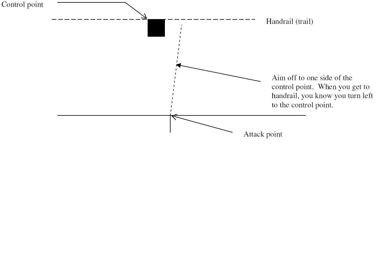
- Aiming off (offset technique)…No one
is perfect with compass bearings. You will always be off to one side or the
other, never knowing which side! When taking a bearing to a control point
that is situated on or near a handrail, aim off to one side of control point.
That way, when you reach the handrail, you know which way to turn to reach
the control point. See sketch below
4. Route Selection:
Once Scouts have been to #1 and #2, they
will review the actual orienteering course with an instructor and discuss what
techniques they will use to find each contol point.
|
|